After our walk around The Burren, we spent the rest of the late afternoon and early evening driving down to Dingle. I wanted to stop off at a couple of places along the way, such as the village of Adare, but we really did not have time. We drove through Adare, and it looked like a pretty place to visit. I had originally tried to book a bed and breakfast there, but nothing was available. Instead, we stayed the night near the entrace to the Dingle Peninsula at a farm, and there was a pub at the end of the road where we had pizzas and bottles of Cola for supper (that was the only option) and where the locals spoke Irish Gaeilge. We had an early night that night so that we could start off bright and early in order to drive around the Ring of Dingle.
Conor Pass
Originally, we had planned to drive up Conor Pass (a pass through the mountains northeast of Dingle town) first, but the road was closed off due to a running/cycling event taking place. Instead, we headed through Dingle town and on the ring road clockwise. Note that later on, we noticed that most people seemed to be doing the drive counter-clockwise. Our first stop would be Gallarus Oratory, which I was keeping an eye open for because it was not sign-posted well.
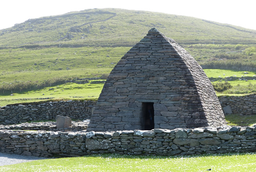
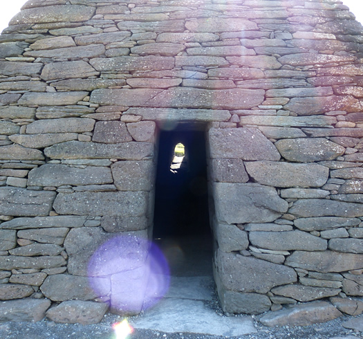
Gallarus Oratory is an early stone church, and it was built in the 7th or 8th centuries. We had to walk about ten minutes to get to the oratory from the visitor centre. At the visitor centre, we watched a programme about it.
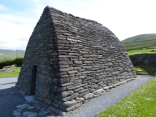
The interior of the church is quite small and dark, and besides the doorway, it has a small window at the back. The stones that were used to construct this church fit perfectly together.
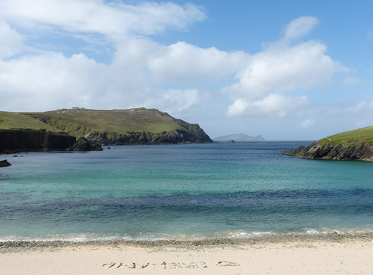
After the visit and a walk around, we headed back to our drive around Dingle Peninsula. We stopped off at a small beach inlet to admire some views. The weather was perfect here.
As we drove further around and up the mountains a little more, some haze and fog descended on the side of the mountain. This side of the mountains was very windy. We stopped off on the top of the cliffs to have a quick look around and admire these views. We did not stay too long because most of the parking areas were pretty full, and there were too many large buses and tourists around.
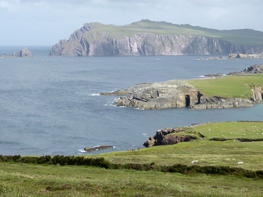
I read some information panels about the geography of Dingle. Ireland was once south of the equator and under the ocean with an abundance of tropical sea life. When the ocean disappeared, Ireland was a desert. The rock formations go through the different eras, and looking at the different type of stone can help to determine its era. Later on, the rock was volcanic and shaped by volcanic activity and mud from the ocean floor. At another point, the glaciers left other rocks from other locations in its path between 2 million and 100,000 years ago.
The views stretched for miles, despite the haze. There are a couple of shipwrecks here too.
We drove further around and came to a place where we could stop and look at beehive huts, which are ancient stone huts shaped like beehives. We almost went in, for a small fee, but we did not as I think we were all a little annoyed that every attraction, no matter how small, requires a fee in order to visit. I thought about the beehive huts that we'd see at Michael Skellig in a couple of days and decided to wait, but I really wish I had not waited now because we were unable to get to Michael Skellig due to extremely bad weather conditions. (In fact, this weather was the last of the best weather that we would have on our visit to Ireland.)
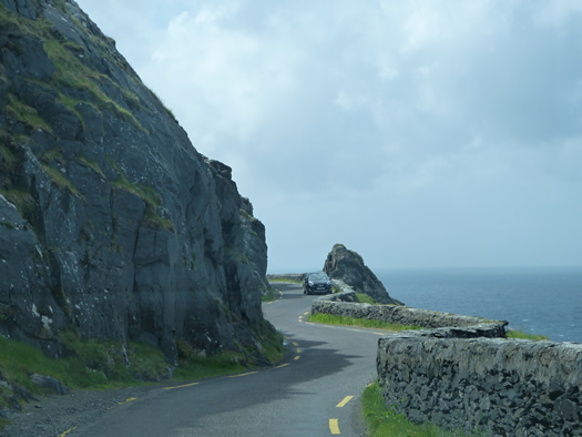
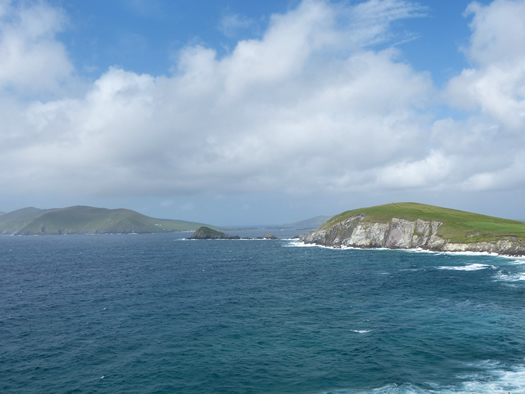
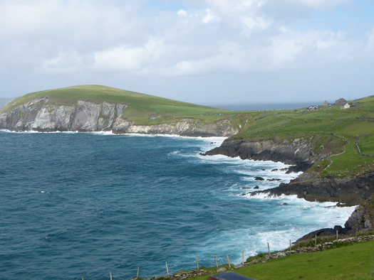
Along the stretch of road with the sea cliffs and winding roads are various places to stop and pull over to admire the views, but the road is narrow too and difficult to maneouver. It seemed that everyone else was driving the opposite way to us. At one point, we saw a cross on the cliffs next to us, and this is known as the Cross at Slea Head. It was pretty much impossible to get a photograph of it because the road was busy and there wasn't a place to pull up to have a look.
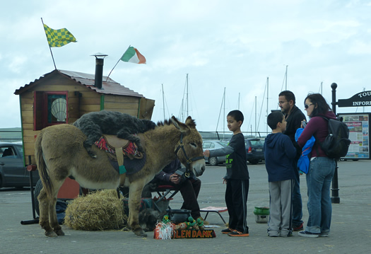
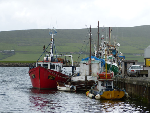
Despite the good views, we were happy to get off the mountains and back into Dingle where we found a place near the harbour to park up. The running/cycling event that I had previously mentioned was still happening in Dingle, so the town was busy. However, most of the event appeared to be happening further up the harbour. We saw a dog sitting on top of a donkey along the harbour, and this seemed to please a group of tourists.
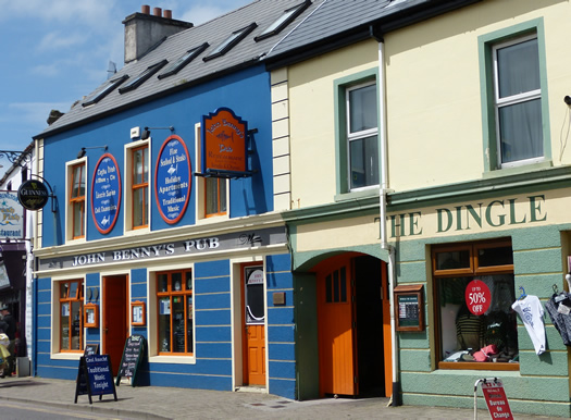
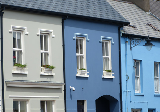
We admired the colourful buildings along the harbour, and a lot of these buildings are pubs. We had lunch in one of the pubs along the harbour front while we waited for our reservation to have a boat trip into the harbour in order to see Fungie the Dingle Dolphin. I'll be including Fungie in a different post.
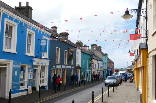
After lunch, we continued having a walk up and down the main streets.
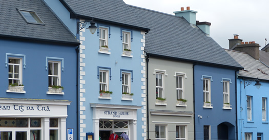
I loved these blue buildings along the harbour front.
No visit to Dingle would be complete without a trip to Murphy's Ice Cream shop. This ice cream has won awards and is famous. I had tried some in Dublin a couple of years ago when I visited Dublin. The ice cream is made from the milk of the Kerry breed of cow. The ice cream has a different taste, and I actually was not as keen on it as I thought that I would be. I have a preference for Italian-style (gelato) ice cream, and this one tasted more milky instead of creamy. However, this is just my preference as the ice cream has won awards so others must really love it.
After our ice cream, we walked back to the harbour and went on the boat tour to see Fungie, Dingle's famous resident dolphin. I'll write more about him in my next post.
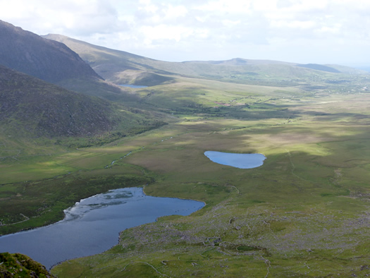
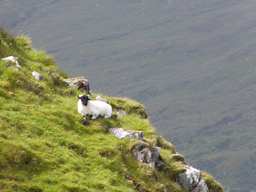
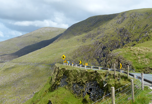
It was finally time to leave Dingle, and we went to Conor's Pass. The roads had re-opened by then so that we could drive up the mountain pass. We were awarded with waterfalls along the side of the road, coming off of the mountain, and amazing views. I loved the brave lamb who sat on top of this cliff with a sheer drop below.
Plenty of parking could be found at the top of the mountain, and there were more information panels to read. I read that the depressions were formed by ice and snow during the glaciers, which left depressions large enough for deep lakes. The glaciers moved north toward Tralee Bay. Around 2 million years ago, the earth began to cool and ice caps formed which covered northern Europe. There were two glacial periods which lasted until about 100,000 years ago, and the landscape of Dingle was created by these moving glaciers.
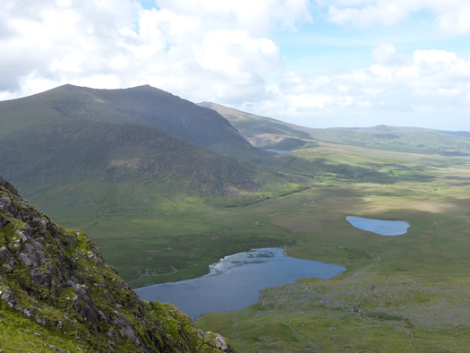
Finally, it was time to leave, and we drove down the mountain, admiring these breath-taking views.
Our next stop would be Kilarney, so keep checking back for my posts on Kilarney and what we got up to there.
Leave a comment