August 2020 Archives

Wallington has been managed by he National Trust since the 1940s and has a diverse history starting with the Fenwick family who owned the estate in the late-1400s until they had to part with it due to financial problems. The Blackett family then owned it and rebuilt the hall in the late 1600s, and it was passed to the Trevelyan family in the late 1700s. So, the property changed hands many times. The Trevelyan family hosted literary and science figures in the property from the 1920s. The property contains 100 acres of woodland, a walled garden, and ornamental lakes in addition to the hall.

wallington_nt

The property was gifted by Charles Philips Trevelyan, who was a Socialist MP, in the 1940s. The hall is Grade I listed, and it was closed during my visit because of coronavirus. The walled garden is probably the best attraction at the site (subject to not having visited to hall), and it is a 10-minute walk through the woods to access it. The flowers were all in bloom, and the walled garden is quite large.

wallington_nt

The shortest route to the walled gardens walks past one of the ornamental ponds, called the "garden pond" as it has plants growing along the banks. There were a few birds on the lake and ducks came to greet us, crying out for food.

wallington_nt

The feature of the walled garden is the little pond and seating area with the steps.

wallington_nt

wallington_nt

A conservatory exists in the walled garden, and the flowers were beautiful here, each in full bloom. I snapped so many photographs of this part of the walled gardens. I am sure the greenhouse was amazing inside too.

wallington_nt

wallington_nt

wallington_nt

wallington_nt

wallington_nt

wallington_nt

wallington_nt

wallington_nt

wallington_nt

wallington_nt

A little doorway with hostas growing on the right led down into the lower part of the walled garden, or there was a doorway outside of the walled garden so visitors can explore the woodland beyond.

wallington_nt

Honeysuckle is one of my favourite summer flowers because of the perfume it gives off. A lot of places seem to allow this to crawl across archways.  

wallington_nt

wallington_nt

At the far end of the gardens is a small pond.

wallington_nt

The other side of the wall garden had more beautiful flower beds. Due to coronavirus, the system was a one-way one because the gardens are impossible to navigate without a one way system to keep a safe distance from other visitors.

wallington_nt

wallington_nt

wallington_nt

wallington_nt

wallington_nt

wallington_nt

wallington_nt

wallington_nt

wallington_nt

wallington_nt

And, this completed the walled garden, back to the feature point at the top.

wallington_nt

wallington_nt

wallington_nt

wallington_nt

wallington_nt

On the way back, I took the longer way, which led around the "Chinese pond", and there is a boathouse on this pond. It was not as interesting as the other pond.

wallington_nt

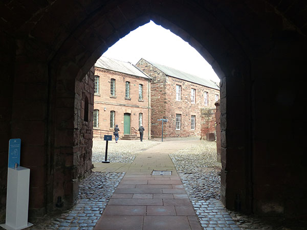
After visiting the gardens, I walked around the front and back of the house. I would like to visit it in the future.

wallington_nt

wallington_nt

The shop is currently closed, sadly. I need to return to get my passport stamp.

wallington_nt

I asked where I could find the dragons that I saw on the map, and I was pointed to the other side of the gardens, so I took an obligatory photograph of the dragon heads. 

wallington_nt

This concludes my visit to National Trust's Wallington walled gardens and parkland, located in Northumberland. I do wish to return to tour the hall once it is safe to do so.

In this post, I cover my walk along the Pennine Way and Hadrian's Wall Walk to Milecastle 39 and Sycamore Gap from Steel Rig car park (and back again). The walk is a breathtaking one with plenty of amazing views from the Pennine Way, which follows the top of the cliffs. With several months of lockdown and getting absolutely no exercise at all during that time (there's nowhere for me to walk to, plus I worked the whole time), I was completely out of shape. It is do-able to Sycamore Gap and back, but the first hill particularly is a slog, and even walking back on the more level route required a hefty slope, but at least it was not near-vertical steps. So, be cautious.

hadrians-milecastle39

The route started at the top of the hill in Steel Rigg car park, which is managed by Northumberland council, and visitors need to pay to park, but the pay covers three hours initially. From the car parking, a footpath descends down the hill into a valley.

hadrians-milecastle39

The below is the bottom of the valley, where there is the Roman Wall in front of you and "Peel Gap Tower" remains, which isn't noticable until you have started to climb the steep hill.

hadrians-milecastle39

hadrians-milecastle39

The steps up are vertical in places with promising views. It's hard work to climb, but it is worth it. It's also not one-way as you have to hug the sides in order for other groups to go around you.

hadrians-milecastle39

hadrians-milecastle39

This is a view from the top with amazing views and the tower remains below.

hadrians-milecastle39

Further along and on the top of the ridge of the cliff hill are a few remains of a turret or watchtower. It would have been a good place for a viewing or signalling tower here at one of the topmost points along this section of wall.

hadrians-milecastle39

This is the Pennine Way walking trail. There are a couple of more hills to climb and descend before approaching Milecastle 39, one of the Roman strongholds along the wall.

hadrians-milecastle39

It's quite clear why they built a tower hill. The enemy could not scale the cliffs we walked up, but this Milecastle is nestled between two hills with easier access for enemies. This is a pretty decent-scale Milecastle. They built these every couple of miles along the wall.

hadrians-milecastle39

hadrians-milecastle39

You can see that there may have been a weakness here that they wanted to defend from the people on the other side of the wall, north of the wall.

hadrians-milecastle39

On the top of this hillside are more amazing views with Sycamore Gap coming into view. This area of the wall is named such because it is a valley with a lone sycamore tree growing up. I did not realise it at the time, but this setting was used in "Robin Hood Prince of Thieves" starring Kevin Costner.

hadrians-milecastle39

This is a fairly steep hill to climb down. It's a stone footpath so mind your step in wet weather. I'm sure these stones could bang you up really well if you make a mistake.

hadrians-milecastle39

hadrians-milecastle39

This is really a picturesque place. There are cattle grazing here too. 

hadrians-milecastle39

hadrians-milecastle39

hadrians-milecastle39

At the bottom of the hill / valley in front of Sycamore Gap is the Hadrian's Wall Walk, a more level walk. Instead of climbing back up the hills, I walked this route back. There was one area where it was difficult to navigate if you're not wearing the right footwear because it is a spring and is quite muddy. Again, be careful on the rocks though there are not as many on this trail. On the other side, you will arrive at the road where you must walk along the road and back up the hill, which is fairly steep and tiresome if you're not in shape. There are views and more cattle, and from here, you can see the Roman Wall along the cliff. The wall would have stood as high as a three-storey building (at least in places), but the wall crumbled or was removed to harvest the stones for farmhouses and other buildings over the years. A shame really...

hadrians-milecastle39

One suggestion would be to start the walk on Hadrian's Wall Walk, which is a more level walk and an easier one without hill climbs. There is one place where there is a spring, so boots are recommended for this section. If I could do the walk again, I would walk to Sycamore Gap on this walk and then walk down via the Pennine Way, although the first steep hill is quite high so I am not sure how comfortable it would be if you suffer from vertigo or a fear of heights. I know a couple people coming down the hill struggled in one particular place because it was a bit narrow without anything to hold onto, and that was just a step or two. But, those views! They are amazing.

hadrians-milecastle39

So, after the walk to Sycamore Gap and back, a hearty meal was needed. I'd booked the General Havelock Inn in Haydon Bridge. I was lucky to have booked because it filled up not long after I had arrived. (Due to coronavirus, they cannot accommodate as many visitors.) It turned out to be a little gem. I had the chicken pie, which was absolutely delicious. Apparently, it's one of their signature dishes too.

hadrians-milecastle39

I did not sit outside, but the weather was nice and I could have done. It's not always comfortable to sit outside and eat because of insects, though if I was visiting for drinks, it would have been an amazing view. Of course, by that time, all of the seats were taken. I did briefly get to enjoy the view.

Vindolanda is a Roman fort and town along Hadrian's Wall that had evolved over the centuries that it was in use by the Romans. It is managed by the same trust that own the Roman Army Museum that I previously posted about. Vindolanda was named after the "white fields", which would have been a result of dew or frost here. It has held many important secrets from the earlier centuries due to the way that the later buildings were built on top of previous buildings and the voids, including the moisture in the soil that helped to preserve important artifacts, such as wood and leather. A museum on site is well worth a visit, and I will be covering this in a different post.

vindolanda

Vindolanda is continuing to give up its secrets as it is currently being escavated.

vindolanda

After the site entrance, modern visitors approach Vindolanda from the town along the main road to the fort entrance. The town consisted of baths, workhouses, shops, and houses that merchants, families, and the wider non-military community lived in. Its safety and security at the fort meant that both the soldiers and the townspeople worked hand-in-hand. The townspeople paid a rent based on how much of the building was road-facing. The fate of the town and fort was tied together.

vindolanda
Baths

vindolanda
Baths

vindolanda
Baths

In the photograph below, the town is visible in the foreground. The walled structure is the walled Roman fort of Vindolanda.

vindolanda
Workhouses/houses/shops in the shadow of the fort wall

A large house here was built on top of an earlier structure, which would have been an even finer house. This may have been where Hadrian stayed while he oversaw the work of the building of the wall.

vindolanda
Workshops

The main road through the town leads to the entrance to the Roman fort, where there would have been a gate.

vindolanda

Inside the Roman fort are the commander's house, headquarter's house, barracks, granaries, and temples.

vindolanda

This part of the site is currently being escavated.

vindolanda
Escavations

vindolanda
Side of a building with structure of stonework

The granaries and storerooms are located in the fort. These were built raised from the ground to keep the items dry. This would have been grain and other items from the greater Roman empire. Sometimes the soldiers had their favourite foods from home lands shipped over, or products grown in other lands were sent over because these products were not grown in Britain. 

vindolanda
Storerooms 

vindolanda

A temple dedicated to Juniper is located in the fort, not far from some of the barracks. An archway separated the barracks from the temple. Carvings were located here and are in the museum, but recreated ones can be seen too. A temple to Juniper is not common, so perhaps this diety meant something to the people who lived in the fort. They would have been auxilary soldiers from other lands of the Roman Empire, enlisted to help for money and Roman citizenship. Many of them stationed here were from the Netherlands, Belgium, and France.

vindolanda
Temple of Juniper

vindolanda
Temple of Juniper replica carvings

One of the barracks leading up to the temple held a sad surprise. A skeleton of a small child of about 10 years of age, was discovered buried in the barracks in the corner. The arms had been bound. Since it was illegal for dead bodies to be buried inside Roman towns and forts, this was a murder. It was determined that the child was probably a female and had not grown up in Britain; she had grown up in the Mediterranian and had moved only a few years prior. As many soldiers lived in one room, more than likely the murder and burial of the child was known by more than one person.

vindolanda
Burial of child in barracks

The below photographs are of the commander's house and headquarters.

vindolanda

vindolanda

In the headquarters, a stronghold storeroom would have held valuables, such as soldier's pay. 

vindolanda

On the edge of the city wall inside the fort, some roundhouses were discovered, but it is unknown what their purpose was.

vindolanda

Down the hill is the museum, which I will cover in another post. Here, a working Roman kiln can be seen, and a milemarker is also seen. This would have given location information.

vindolanda

There is also a reconstruction of a temple.

vindolanda

Part of the wall and tower has been reconstructed (below).

vindolanda

I will be covering the museum at Vindolanda in another post, so keep visiting to see more photographs.

Back at the end of February or early March, Dominique Ansel opened their new "Tree House" restaurant in Covent Garden. I was working in the area and looking forward to a visit and walked past it a few times, but then coronavirus happened. As a result, the doors to the "Tree House" never reopened. Their first branch, located on Elizabeth Street near Victoria, did reopen but will only be trading in London until the end of this month. This is due to coronavirus. I think that some time must pass before restaurants can begin to make money again. Restaurants such as Dominique Ansel were always busy pre-COVID, but they are now struggling. Rent has always been very high, especially in the middle of London, so I am sure many businesses cannot afford to remain open with the decreased footfall. I don't know what will happen in the coming months, but I have hope that the ever-resilient city of London will recover from this. 

dominique-ansel-watermelon2.jpg

I always wanted to try the watermelon soft serve. I absolutely love watermelon...I may be slightly obsessed with watermelon. I know this treat has been on the menu for awhile, but I had not visited the restaurant at the correct season before. The treat contains a very picturesque watermelon slice, filled with watermelon sorbet with dark chocolate pieces in the shape of seeds placed onto it. Let me say that it was delicious.

dominique-ansel-watermelon1.jpg

Dominique Ansel are hosting afternoon teas and serving up your favourites, such as the watermelon sorbet, until the end of the month. I also purchased one of their infamous cronuts, which they are credited for developing (a cross between a doughnut and a croissant). Each month is a new flavour, and their final flavour is banana and peanut butter. Banana and peanut butter are not my favourite flavours, but I still enjoyed it. 

dominique-ansel-watermelon3.jpg

The room at the back of the restaurant is decorated for the spring.

dominique-ansel-watermelon4.jpg

Do visit if you wish to have a final cronut or watermelon soft serve or any one of their other popular treats. Dominique Ansel is located on Elizabeth Street, and it is between Victoria and Sloane Square stations. Maybe they will return to London one day when visitors return.

At the end of last month, Trafalgar's Fourth Plinth in London was graced with a new artwork, replacing the commission that has been gracing the plinth for the past two years ('The Invisible Enemy Should Not Exist' by Michael Rakowitz on Trafalgar Square's Fourth Plinth). For the next two years, the fourth plinth will be the home of the new artwork by Heather Phillipson, "THE END". "THE END" is the tallest sculpture on the fourth plinth so far and is a sculpture in the shape of a giant dollop of whipped cream with cherry on top. A giant fly has landed on one side of the cream, and on top of the cherry on the other side, a massive drone has landed. This drone's propellers move, showing a dimension to the sculpture as a statement that it is alive and watching. The statue appears to be a whimsical piece with dark undertones: drones symbolising decreased privacy and flies symbolising a dirty pest of death, churning stomach when around food. 

heather-phillipson-4thplinth1.jpg

Every two year's, Trafalgar Square's fourth plinth gets a new artwork. The plinth was originally created for a statue of William IV, but the funds were never sufficient, so the fourth plinth has been used in the past 13 years to place a new artwork.

heather-phillipson-4thplinth2.jpg

Previous commissions that had time on the fourth plinth in Trafalgar Square can be seen in the following posts:

2018: 'The Invisible Enemy Should Not Exist'
2016: Really Good
2015: A horse skeleton with a stock ticker tape
2014: A giant blue rooster
2012: A boy on a rocking horse
2011: Ships in a bottle
2009: members of the public were encouraged to do their own 'thing' on the plinth
2005: limbless pregnant female

Zabou: "Jack the Ripper" Street Art

| No Comments | No TrackBacks

At the start of lockdown, Zabou was in the process of painting a new mural just off Toynbee Street on the back of "The Wellington" pub. The mural features the infamous Jack the Ripper peeking out of a wall with trademark deerstalker hat, staring crazily down at the pavement below. Most of the "Jack the Ripper" murders happened in this area with a piece of bloody cloth left with a message on Goulston Street, just around the corner from here and the closest and last murder scene attributed to the Ripper in what was Dorset Street literally around the corner. Dorset Street is known as White's Row today, and the ground where the low income accommodations occupied had included a parking garage in more modern times, but this was replaced with an office block in the past couple of years. A barber shop with the pun-name "Jack the Clipper" is also located nearby.

zabou-ripper1.jpg

The Jack the Ripper mural brings back the element of history to this part of east London and the grim reminder that this part of London was very poor and laden with crime and disorder in the not-so-distant past. The Ripper murders took place in the late 1800s, and that's only been about 140 years ago. 

zabou-ripper2.jpg

Obviously, the identity of Jack the Ripper was never discovered and will never be discovered now, and there are many theories as to who it may have been. Nevertheless, the Ripper is synonymous with the history in this part of east London. Tourists can take walking tours and ghost tours in order to be transported back into these dark times. Rest in peace to the unfortunate women who became the victims of this crime and of other murders and crimes in this dark period of the history of London.

zabou-ripper3.jpg

Previous Zabou murals that have appeared on this blog include:

Zabou: 'Racism is a Virus' Street Art
New Murals by Zabou in East London (Clockwork Orange, Sherlock, David Bowie)

Zabou "The Shining" and Refresh of Salvador Dali in Spitalfields
Villana and Zabou Collaborate on Amy Winehouse Street Art
Zabou paints Sid Vicious from 'The Sex Pistols
'
Zabou Paints Freda #2 at Broadway Market

Zabou Paints Salvador Dali on Commercial Road
Koeone and Zabou Collaborate
"Keep Out!" Street Art by Zabou
Zabou's 'Cabinet of Curiosity' Street Art
Leake Street Tunnels Street Art, Spring 2016
Recent Street Art by Zabou
Street Art: Zabou

Corbridge was the site of a series of Roman forts built around the year 75 to protect the road and river. It later became a thriving town that was occupied for over 250 years. The town expands more than 40 acres, but most of it is currently covered in pasture. Only a small section, the uncovered middle of the town, is visible to explore. The town's roads were repaved at least twice, and this required steps down to the lower level from the road level. Only a fraction of the town has been uncovered.

corbridge01.jpg

Two granaries (or a granary and a storehouse) are located in the town to store grain off the ground with airflow underneath it. These may have been buildings from when Corbridge was a fort.

corbridge02.jpg

corbridge03.jpg

corbridge04.jpg

A decorative fountain was located near the granaries, and this would have provided a feature point and allowed water. 

corbridge05.jpg

corbridge06.jpg

The remains of the commander's house and headquarters were discovered from the Roman fort days, but this was the main street when it was a town. The fort is buried beneath other ruins. A hoard of armour and personal items was found buried here by a soldier from the time of the fort, and this can be seen in the museum.

corbridge

There was a large building used as a storeroom with many workshops inside it, possibly to supply the Roman army and the villages with supplies.

corbridge

corbridge

corbridge

Two army compounds for two separate legions were part of the town, and they were both walled in.

corbridge

corbridge

corbridge

corbridge

corbridge

This was a location where offerings could be left.

corbridge

One of the army compounds contained a sunken stronghold for valuables.

corbridge

corbridge

The unlevel ground occured when the town was further developed and built upon for different uses with the structures on top eventually making the ground unlevel as the ground filled voids and old walls after settling. 

corbridge

These fields near Corbridge looked pretty, and I am sure there are many buried treasures in them.

corbridge

corbridge

The museum at Corbridge is very good. The below is a grave marker, and it was later reused as a fountain.

corbridge

The below is located in the museum and is a reproduction of a tray made of silver that was found buried on the outskirts of Corbridge along with several other silver items. It was probably made in the mid-400s and was discovered in the 1700s. The original one is located in the British Museum. It was probably buried for safe-keeping; maybe times were troubling. Whatever happened, the owners never reclaimed it.

corbridge

The rest of the items are from the museum of pieces that I found interesting and that came out well! Some of these are rings with inscriptions, medical and clothing items, personal items, religious items, markers, pottery for storage and an oil or perfume pot made of alloy. 

corbridge

corbridge

I recommend a visit to Corbridge as it is a unique Roman town / fort with a lot of history, and the museum was also really good with a lot of interesting items to see and read about.

While exploring Hadrian's Wall in Northumberland/Cumbria, I visited the Roman Army Museum. The Roman Army Museum has everything you ever wanted to know about the Roman soldiers who were stationed at Hadrian's Wall, notably Vindolanda where the artefacts on display came from. Overall, it took me a couple of hours to walk around the museum, watch a 3D video about the wall and listen to projections of Roman soldiers/scholars teach Latin or new recruits. Outside the museum is a photo opportunity with the number of miles between Rome and the nearest two Roman forts to the museum that can be visited today.

roman-army-museum

The first part of the museum described the make-up of the legions or troops, where they came from, what they wore, and what they carried around with them.

roman-army-museum

In this part of the museum is the most unique find. It is the Roman helmet crest, which was found at Vindolanda. The crest is the only one in the world that has survived, and it is approximatel 2,000 years old. A lot of perishable items were discovered at Vindolanda because of the moist cavity in between building work or renovations during the Roman times. A lot of leather was also discovered as well as tablets, which gave an insight into the lives and diets of the Roman army. The other find underneath the crest is a medal awarded to one of the Romanian soldiers and was quite and expensive item.

roman-army-museum

A statue of Hadrian accompanies information about the emperor who was responsible for building the wall. Information panels explain the length of the wall and the ruins and sections of the wall that can be visited and hold some interest.

roman-army-museum

The museum also has a lot of metal and stone items that the soldiers would have used day-to-day.

roman-army-museum

There is a small selection of what appears to be unworked leather and leather shoes on display here, but an even larger selection is on display at Vindolanda.

roman-army-museum

roman-army-museum

Religion also played a factor in the lives of the soldiers. Some of the gods and goddesses were imported from Rome, but many were either local dieties or dieties from the home lands where the auxiliary soldiers came from. These were soldiers from other conquered lands in the Roman empire who were enlisted as soldiers for a time and paid a wage. Eventually, if they lived long enough, they would become Roman citizens for their service.

roman-army-museum

roman-army-museum

Two examples of chariots are located in the museum. One is Roman, and the other is Celtic. The Celtics used chariots in battle against the Romans.

roman-army-museum

A small selection of coins can also be seen in the museum.

roman-army-museum

I suggest a visit to the Roman Army Museum if you are visiting Hadrian's Wall because it provides an additional level of appreciation and understanding of Hadrian's Wall and Roman Britain heritage. Hadrian's Wall and area is a UNESCO World Heritage site.

Cawfields Roman Wall and Milecastle 42

| No Comments | No TrackBacks

Cawfields is a location where the Roman Wall is accessed and where a quarry was dug, which took part of the Roman wall away with it when it was dug in the 1940s. The wall can be walked from here, and the parking is located in front of the quarry with a short walk to the wall and milecastle. There are lovely views from here.

cawfields01.jpg

Upon leaving the car, I walked around the side of the quarry. On the steep hill in the photograph below, the old Roman Wall rises here before the cliff's edge has been taken away, with the remaining wall.

cawfields02.jpg

cawfields

cawfields

The views are stunning from Milecastle 42. These Milecastles were lookout towers for the Roman army so that they could see the land on the other side and defend their claimed territory. The milecastles were located almost every two kilometers, and this one is located in a weak point in the wall where it could be easy to miss intruders arriving from the flat part of the land on the opposite side of the wall.

cawfields

Milecastles would have had several men standing to watch at all hours at these points. From this point, the fort at Housesteads is about eight and a half files away.

cawfields

This looks like a particularly large Milecastle to me when compared with some of the other ones.

cawfields

Have you ever visited Cawfields or walked part of the Roman Hadrian's Wall?

Zabou: 'Racism is a Virus' Street Art

| No Comments | No TrackBacks

London-based street artist Zabou painted a powerful "Racism is a Virus" mural on the side of The Bell pub near Petticoat Lane at the end of June to correspond with the "Black Lives Matter" protests that took place across the world (including London). Zabou is known for her colourful and realistic portraits, and her work is always powerful. I was happy to see the new mural on social media although I was unable to get a photograph of it until recently.

zabou-racism-is-a-virus1.jpg

The portrait is inspired by a photograph from futurehackney (https://www.instagram.com/futurehackney) and was taken during the Black Lives Matter London protests. It is a powerful photograph as well, and that photograph can be seen here: https://www.instagram.com/p/CBSUnVHHC75/?hl=en. 

This mural is a reminder that there is so much to do to combat racism.

zabou-racism-is-a-virus2.jpg

Previous Zabou murals that have appeared on this blog include:
New Murals by Zabou in East London (Clockwork Orange, Sherlock, David Bowie)
Zabou "The Shining" and Refresh of Salvador Dali in Spitalfields
Villana and Zabou Collaborate on Amy Winehouse Street Art
Zabou paints Sid Vicious from 'The Sex Pistols
'
Zabou Paints Freda #2 at Broadway Market

Zabou Paints Salvador Dali on Commercial Road
Koeone and Zabou Collaborate
"Keep Out!" Street Art by Zabou
Zabou's 'Cabinet of Curiosity' Street Art
Leake Street Tunnels Street Art, Spring 2016
Recent Street Art by Zabou
Street Art: Zabou

Chester's Roman Fort is managed by English Heritage, and it was the fourth Roman fort that I visited along Hadrian's Wall so that visitors can see the escavated ruins. (A list of the others that I visited will be at the end of this post.) It was probably my favourite of the Roman forts that I visited as it is fairly well-preserved (particularly the bath house) and has impressive river and countryside views. Keep reading to learn more about this Roman fort and to see photographs of my visit.

cheaters roman

Chester's Roman Fort (or Cilurnum, as it was known by the Romans, which was possibly named from the tribe that the men belonged to), was a cavalry fort. The different forts along the wall seemed to have their own specialties, and this one was made up of a group of men from northern Spain who were regarded with their equestrian skills. They were auxilary soldiers - people from lands conquered by Rome who were paid a wage and who could become Roman citizens after a time. Before moving to Britain, they served in modern-day Hungary.

cheaters roman

The pastures beyond the fort (outside of it) was the location of the town that grew up around the fort to support it with various activities and supplies outside of the life at the fort. In the 1830s, the land here was inherited by John Clayton, and he spent time uncovering the ruins and buying more land with ruins in order to discover the secrets the Romans left behind.

cheaters roman

Upon entry to the site, visitors pass through the ruins of one of the gates that would have been used to enter the fortress in Roman times.

cheaters roman

The barracks (pictured below) held roughly 500 men with 32 men to a building. The men lived in quarters with their horses in the front room with three men to a room. They had to take good care of their horses because they paid a deposit for them. Horses had to be looked after and groomed daily.

cheaters roman

cheaters roman

cheaters roman

cheaters roman

cheaters roman

The main east gate led out of the fort to the river and the bridge. The remains of the bridge can be seen on the opposite side of the river, but there is no way to cross the river, so this must be looked at separately. The bridge would have looked impressive and imposing, and some of the information boards depicted what it would have looked like.

cheaters roman

On the banks of the river is the Roman Bath. This was located outside the fort and would have been communal with soldiers and citizens outside the fort. In escavating the baths, 33 skeletons were discovered in one of the rooms, but they have disappeared before anyone could study them. Some intact mosaics were also discovered in the escavations.

cheaters roman

The idea of the bathing ritual was to work up a sweat through exercise or sitting in one of the hot/steam rooms in the bath house. While in the hot rooms, oil could be used on the skin to scrape off dead skin and dirt before plunging into the cooler baths to close the pores.

cheaters roman

cheaters roman

cheaters roman

Below is one of the steam rooms near the furnance where bathers would have been seated. It had under-floor heating delivered by a furnance. I am sure this would have felt good in the cold British winter months.

cheaters roman

cheaters roman

Below are the ruins of the commander's house. It looks like it had its own private bath.

cheaters roman

cheaters roman

cheaters roman

Below is the fort headquarter buildings where they would have had meetings and celebrations. It was a large building. This is also where they had a sunken treasury room for valuables.

cheaters roman

cheaters roman

cheaters roman

cheaters roman

That concludes my visit to Chesters Roman Fort. Due to coronavirus, the museum was closed. I hope to return once the museum is re-opened to the public and it is safe to visit.

On the eastern end of Hadrian's wall between Housesteads and Chesters is the old Roman fort Carrawburgh (known as Brcolita to the Romans). The Roman Wall here was demolished to build the road through it, and the fort is overgrown with only the earth indicating of a former structure. However, the gem is the ruins of the Temple of Mithras, and it remains in the valley and a short five-minute walk from the parking along the main road.

Brocolita-mithras1.jpg

The Temple of Mithras was a cult popular with Roman soldiers, and there is still a lot of mystery surrounding the cult and what the beliefs were, although my post (A Visit to the Temple of Mithras, London Mithraeum) earlier this year when I visited the Temple of Mithras in London has some more information. In short, the temple was dedicated to the god Mithras, and a bull and astrology seems to play a part in the rituals.

Brocolita-mithras

Stone carvings and altars were discovered in the temple, which was discovered in 1957. Additional sites and buildings related to Mithras were discovered here as well, and one of these was worship of Roman-British goddess Coventina; at the well/spring, offerings have been found. The well and other buildings are no longer visible, but I think the site shows the importance of traditions for the soldiers and the blend of different cultures and beliefs between the groups of people that Rome conquered.

Brocolita-mithras

There is a short walk down to the temple through the fields where sheep and lambs were grazing.

Brocolita-mithras

The temple lies in the valley.

Brocolita-mithras

The altars remain, and people who have passed through have left their own offerings.

Brocolita-mithras

Brocolita-mithras

Brocolita-mithras

The old fort itself can be found just above the temple, but there's nothing left except the unlevel earth that appears to be disturbed over the centuries.

Brocolita-mithras

To read about my visit to the Temple of Mithras in London, view this post: A Visit to the Temple of Mithras, London Mithraeum

London-based artist Ant Carver has recently created a new mural on the ever-popular wall on Hanbury Street. The mural was just finished in the middle of last week and features a girl with a golden skull. Illustrations of portraits feature quite heavily in Carver's work, but it has only been recently that the artist has created photo-realistic murals. In particular, this mural gives attention to the model's hair, drapery, and lighting.

antcarver-2020-1.jpg

The artist has recently been focusing on loss and reflection, and the three candles represent the loss of a close friend. 

antcarver-2020-2.jpg

antcarver-2020-3.jpg

More work by Ant Carver that I have covered on my blog include:

Street Art: Ant Carver
Ant Carver Portraits of Models
Ant Carver Pastes New Portraits on East London Streets
Portrait of a Girl on Hanbury Street
Ant Carver Adds More Paste-ups to Sclater Street
Camden Street Art Self-Guided Trail

Gibside, a National Trust property in Tyne and Wear, has acres of grounds with views to explore. Gibside belonged to the Bowes-Lyon family, a family of politicians and landowners. Queen Elizabeth II's mother descended from this family. The family had been living in the estate since the 1540s, and the mansion dates from the early-1600s. Unfortunately, the mansion is a ruin today. The site also has a chapel, stables, monument, banqueting hall, walled gardens and an orangery.

gibside national trust

The first stop on the visit was to the walled gardens, before I explored some of the other attractions at this huge site. The walled gardens contains fruit trees and mainly wildflower gardens. Poppies and cornflowers (my favourite flower) were in abundance. Most of my photographs are of the walled garden.

gibside national trust

gibside national trust

gibside national trust

gibside national trust

gibside national trust

gibside national trust

gibside national trust

gibside national trust

gibside national trust

gibside national trust

gibside national trust

gibside national trust

gibside national trust

gibside national trust

gibside national trust

gibside national trust

One of the remaining features that date from the 1700s is a "plant theatre". This little alcove contained prized plants, and these were normally selected by the head gardener. It is currently used to showcase displays. A few years ago, work was commissioned by a florist and the design featured golden pineapples. This celebrates the heritage of Gibside because pineapples were grown here. 

gibside national trust

gibside national trust

gibside national trust

Gibside had ongoing improvements by the Bowes-Lyon family throughout the 1700s and early 1800s, including landscaping and the banqueting house, column of Liberty, stables, avenue of oaks, and much more. The hall was also extended. The estate was landscaped with the views in mind.

gibside national trust

gibside national trust

gibside national trust

The orangery is one attraction, and it is a ruin today with flowers growing amongst it. There are spectacular views from inside.

gibside national trust

The long "avenue" of trees starts at the chapel, which you see in the photograph above; a close-up of the chapel is below. Normally, the chapel is open for visitors but is currently closed due to coronavirus. It was built as a Calvinist church.

gibside national trust

On the other end of the avenue is a monument, a column to British Liberty.

gibside national trust

Opposite the view of the column are the stables. Today, the stables are a cafe, but this is closed due to coronavirus. The stabled were built in the mid-1700s.

gibside national trust

Not to miss out, the ruins of the old hall (Gibside Hall) are off to the side of the avenue with impressive views behind. The house became neglected after 1860, and the walls have been stabilised so that visitors can walk around the ruins, but this seems to be fenced off currently, probably due to coronavirus again.

gibside national trust

Further up past the stables is the octagon pond and banqueting hall above that. The banqueting hall was built in the mid-1700s. I thought it looked a bit "creepy" today as it is all overgrown without the manicured lawns. The octagon pond has also lost its shape. It has not been restored due to a rare colony of newts in the pond. But visitors can try to imagine how it would look if the overgrown plants were removed and the fountains and statues were placed in the view.

gibside national trust

After the long walk (Gibside has over 600 acres to it with the buildings all spread out), I enjoyed some ice cream outside the cafe near the entrance, which was open but selling a reduced range of items.

gibside national trust

At some point, I plan to return once the buildings are re-opened and the world is free from the dangers of coronavirus.

Hadrian's Wall: Walltown Crags

| No Comments | No TrackBacks

Today's post covers the section of the Roman Wall (Hadrian's Wall) at Walltown Crags, which is one of the best-preserved places to see the wall. Here, the rocky outcrop of the hills has been used to build the wall and incorporated into it. This is an amazing place to see the wall and can be walked. Also located here is Walltown turret, one of the standing towers that the Romans built along the wall every half a mile or so in order to protect it whilst maintaining watch below at the northern edge of their Roman empire.

walltown-crags1.jpg

Access to Walltown Crags is fairly easy as there is a small amount of parking at the bottom of the hill, but visitors must walk up a fairly steep and uneven hill through pastures of grazing sheep in order to get to the top. 

walltown-crags2.jpg

walltown-crags3.jpg

Once at the top, there are good views, and I examined the old tower first. This would have at least been three storeys high, but it's a brick wall today, and visitors can see its footprint. 

walltown-crags4.jpg

With the amazing views here, this would have been a very important strategic point for the Romans. They could have signaled to other towers along the wall from here.

walltown-crags5.jpg

walltown-crags6.jpg

I did not walk the wall section here because I did not have a lot of time, but I climbed to the top of the hill to examine the tower and views. This is an impressive location, and I would return here to walk a section of the wall.

Housesteads (known as Vercovicium to the Romans) is a Roman fort and town built on a hillside along Hadrian's wall. Of the sixteen forts along the wall, this one is the best-preserved and dates from mid-100AD for almost 300 years by Roman soldiers. While some of the area has been uncovered, parts of it remain buried beneath grass and soil. In addition to being able to walk around the ruins of Housesteads, visitors can also have a look inside the museum. I suggest that visitors start with the museum first before continuing up the hill to Housesteads.

housesteads01.jpg

Hadrian built the wall after the previous emperor had conquered a lot of the lands. Instead of expanding the empire, Hadrian visited the far reaches of it and built defenses to continue to keep the northern people out of the land south of the wall. 

housesteads02.jpg
Ten or fifteen-minute walk to Housesteads site

housesteads03.jpg
Museum

The Romans would have brought influences with them from the wider empire, and the conquered people in the British islands would have had their own beliefs, and they would have merged with the Roman ideals. In one of the buildings, this stone carving was found with three robed/hooded figures; it was most likely in a shrine.

housesteads06.jpg

All of the Roman forts were built with the same format with the barracks, granaries, commander's house and headquarters, and hospital. The museum showed a variety of items from stone carvings to metal working items discovered to pieces of pottery and glass and jet for jewellery.

housesteads04.jpg

The commander's house had under-floor heating, kitchen, and quarters for servants as well as its own stable and latrine. The commander would have been a Roman citizen of high standing in society.

housesteads05.jpg

These items were discovered in the hospital and included a mixture of medical instruments and preventative measures, such as jet to ward off evil. A figure of Venus was probably carried for fertility. The hospital may have been two floors and all Roman soldiers were skilled in first aid, and others would have been professionally trained; each military unit had their own doctor and trained medical staff.

housesteads12.jpg
Hospital

The fort and town were abandoned after Rome could no longer hold onto the land, and the people of the north kept invading and destroying the defenses. The defenses were attempted to be rebuilt but out of wood and not stone. The Romans lost control and the government collapsed, and they abandoned Britain. As time went on, the land was used by farmers. Farmhouses (bastle houses) were built on the land in the middle ages, which allowed some form of defense. These structures are mixed within the older ruins.

housesteads10.jpg
Granaries which were built off the ground to keep grain dry

Ten identical barracks were built, and these were small rooms; up to eighty men would live in one building. A larger room was for the centurion. Each room was lived in by eight men. The room was split in half with half of the room for sleeping and cooking and the other half (at the front) for the equipment. The roof would have extended out to cover the street so that the soldiers could relax outside.

housesteads08.jpg
Barracks

housesteads11.jpg
Barracks

One rare item inside the fort was the addition of a small bathhouse. Usually, bath houses were located outside the fort, but it is possible that it had to be inside due to outside threats.

housesteads07.jpg
Baths

Along the walls on the edge of the forts were ovens where bread could be baked.

housesteads09.jpg
Bakehouse

housesteads13.jpg
Granary

housesteads16.jpg
I believe this is a latrine in the commander's house or hospital

housesteads14.jpg
Gate entrance and stables

housesteads15.jpg
Roman wall and milecastle in valley (to the left)

housesteads17.jpg
Commander's house

housesteads18.jpg
Wall at the edge of fort

The latrines at Housesteads are in very good condition and well-preserved. The latrines have a trough arounnd them, which would have been covered by a wooden floor with seats to sit on. 

housesteads19.jpg

housesteads20.jpg

Outside the fort was the town, and the remains of some buildings can be seen. This is where trades people and merchants would have lived with protection of the fort. The soldiers would have had their families live here too, and there would have been shops and pubs here. In one of the houses outside, two skeletons were discovered buried, which hints that this would have been a murder that had taken place. 

housesteads21.jpg

Housesteads has impressive views, and visitors here can also walk further along Hadrian's Wall and to additional milecastles and Sycamore Gap. 

When I lived in Basingstoke, I visited the Milestones Museum (a living history museum) with my parents when they came to visit. Basingstoke is blessed to have a lot of cool attractions - museums, theatre, etc. Milestones Museum also hosts several events throughout the year. The museum has a small village (street scenes) underneath a domed shelter. The museum integrates equipment and vehicles into the scenes in order to give visitors and understanding of life in days long gone. 

milestones-basingstoke1.jpg

milestones-basingstoke2.jpg

milestones-basingstoke

milestones-basingstoke

milestones-basingstoke

milestones-basingstoke

milestones-basingstoke

milestones-basingstoke

The museum is a must-visit if you want to understand how people lived in the past and have an interest in vehicles and machinery.

In the last year, I discovered several new walls painted with the toothy smiles and grins from London-based street artist Sweet Toof. The artist often paints these toothy smiles on London's walls as they inspire a sense of identity; the last time that the artist created the work on the streets was about three years ago. The work is sometimes a collaboration with other artists who have been on London's street art scenes for awhile. Below are the newest editions of the artist's work, which was mostly centred on Brick Lane.

sweettoof2019-1.jpg

sweettoof2019-2.jpg

sweettoof2019-3.jpg

sweettoof2019-4.jpg

sweettoof2019-5.jpg

sweettoof2019-6.jpg

For more information about Sweet Toof and to see more of his work, see the following posts:

Street Art By Sweet Toof, Mo, and Gold Peg
Street Art: Gee, Paul Insect, Sweet Toof, Bortusk Leer

I recently visited Birdoswald Roman Fort (known as Banna) along the western end of Hadrian's Wall. This is one of the best-preserved forts along the wall and is open to the public, maintained by English Heritage. The fort is built on a hill and has views from all sides over the valleys and a river, so it was the prime location for a fort. The name of the fort was 'Banna' in Roman times, and this translates to "horn" in Celtic, which describes the shape of the site. It was occupied in 114-400AD primarily by Roman workers from foreign lands (called auxilaries) who had yet to gain Roman citizenship and were from the wider empire. Those stationed here were from Romania.

birdoswald01.jpg

The fort is not completely escavated and most of it remains below soil. However, some of the walls and the outlines of some buildings can be seen. These include the usual barracks, commander house, public buildings, and granaries for storage of food. The fort also had its own exercise building, which was rare and possibly demonstrates that the land was exposed to the elements and required an indoor room for exercise. 

birdoswald

The site began escavations in the early 1900s with slow progress. Most escavations were more recent. The farmhouse located on the site is of more recent design and houses a small museum about the Roman wall, the army, and a few artefacts discovered on site. The farmhouse was built to withstand thieves who did target the house; a ladder could be drawn up to protect valuables inside the house if it was sieged.

birdoswald
Barracks 

birdoswald
Museum

The walls would have been three storeys high where built up. Earlier turf walls remain as the Romans used the natural landscape for defense and also dug ditches on the other side of the wall to slow down any enemies who sought to attack.

birdoswald
east gate

The fortress had three main gates, and the remains of all of these can be seen. The east gate is the best preserved gate into the fortress.

birdoswald
south gate

Outside the east gate are spectacular views over the valley. Right outside the gate is a device that can be tapped or lightly struck with a stone to make music with each bell producing a different pitched tone. This was a nice touch to make the area magical.

birdoswald

birdoswald

The hillside has since eroded away from when the Romans were here 2000 years ago. Some buildings, including a bath house, were thought to have eroded into the valley. The cemetary outside the walls was also left exposed, and the ground was stabilised to prevent further erosion of the site. At this time, some of the urns were discovered and are now in the museum.

birdoswald
Burial urns

The old Roman wall follows the site outside the fort, and it can be followed for miles and is an attractive stretch of wall. 

birdoswald

In the photograph below, the wall is located to the right with a modern wall in the foreground.

birdoswald

Since much of Birdoswald (or Banna) remains covered, I am sure that there are many more treasures hidden below the surface.

Carlisle Castle is located in Cumbria and was built in the late 1000s; at this time, Cumbria was part of Scotland. The castle was originally a Norman-style motte and bailey one at the site of an Roman fort dating from 72AD, known as Luguvalium. The existing castle keep dates from the early 1100s. The castle has seen a lot of action over the years and is the most sieged castle in the UK as it was on the northern border, and Mary Queen of Scots was a prisoner here. It was used in the Civil War and also the Jacobite uprising before becoming neglected in the late 1700s. The grounds were used for militarty purposes in more recent times before becoming a tourist attraction. The castle can be visited, and the Cumbria Museum of Military Life is located inside the grounds.

carlisle-castle01.jpg

From the 1700s, some of the castle was demolished, and the stone from it was used for other buildings. Barracks here were occupied in the 1850s with soldiers and officers living here with their families. 

carlisle-castle02.jpg

The castle contains historic graffiti, but with the current conditions, there was not any signage to point this out. 

carlisle-castle03.jpg

Post-lockdown, a one-way system is in place to visit the castle, and the upper two floors of the keep are shut off from the public currently due to this (because a one-way system cannot be implemented). Visitors can visit the half-moon battery in front of the inner courtyard, which is just a semi-circular hallway at moat level.

carlisle-castle

Inside the castle, visitors could walk around the castle walls. The tower where Mary Queen of Scots was imprisoned has been demolished, but the area where it stood can be seen on one of the far corners.

carlisle-castle

carlisle-castle

The above buildings were used for the military history, and the below image shows the entrance to the castle keep.  

carlisle-castle

Visitors can explore a couple of rooms on the first level of the castle, including the great hall. At the bottom of the castle, on the ground floor, visitors can explore the store rooms and dungeon, which were dark and damp rooms.

carlisle-castle

After visiting the castle, I had a quick walk to Cumbria's Museum of Military Life. The cafe is also located here and was open with seating outside. The museum included items, weapons, medals, propaganda, personal items, and uniforms from the major conflicts in the past couple of hundred years - Boer War, India, World War I, World War II, and the most recent in Afghanistan.

carlisle-castle

carlisle-castle

carlisle-castle

When the current virus is no longer a threat, the museum should be fully open to the public again, but at least it is an attraction that can be visited while most of us are unable to and do not wish to go abroad this year.

Street Art: Unknown Plaques

| No Comments | No TrackBacks

I photographed two of these different street art plaques by an unknown artist in street London awhile ago. I never did find out who the artist was as they do not appear to be tagged, so please let me know in the comments if you know who the artist is. There were two different ones that I managed to capture with different text. They appear to be created with found items and tiles.

streetart-unknown-placqueart1.jpg

"On Feeling Nourished"

streetart-unknown-placqueart2.jpg

"There is No Free Will in Nature"

Both of them caught my eye and provoked some thought.

Archives

Recent Comments

  • jenn: Thank you. read more
  • Murge: Amazing post. read more
  • Herbert: good post. site read more
  • Frank Quake: Hey, This is great when you said that I had read more
  • Chappy: You mention peptides here? I have had first hand experience read more
  • jenn: Thanks! I love the work. I have got more recent read more
  • Fanakapan: Thanks for the write up. This was some of my read more
  • jenn: Yes.... but that's only for the islands. Mostar and Montenegro read more
  • jenn: Hello, the code is not mine to hand out. I'll read more
  • pantich: More info about the best day trips from Dubrovnik can read more
OpenID accepted here Learn more about OpenID